support@azansys.com +91-9389638738
Our Services

Transforming Industries with Advanced Aerial Intelligence
At Azansys Technologies LLP, we specialize exclusively in designing, manufacturing, and deploying cutting-edge drones tailored for diverse industry needs. Our fleet of drones is 100% made in India and engineered to deliver high-performance aerial intelligence — enabling smarter decisions, safer operations, and enhanced productivity.
Whether you're a farmer, construction planner, disaster response team, or security agency — our drone solutions are designed to save your time, reduce costs, and provide unmatched efficiency through the power of aerial data.

Our Drone Services

Skyward Innovation, Groundbreaking Precision

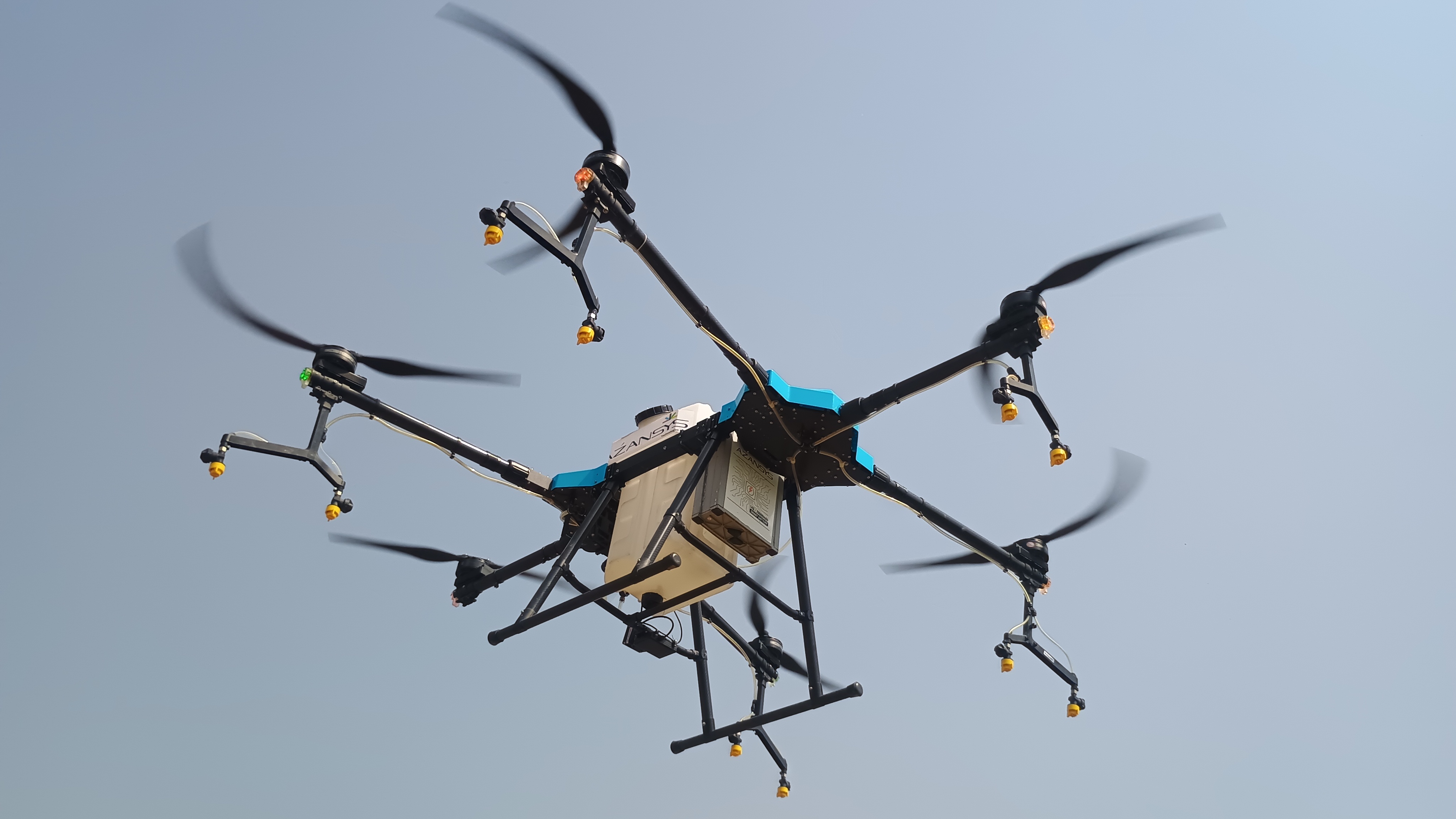
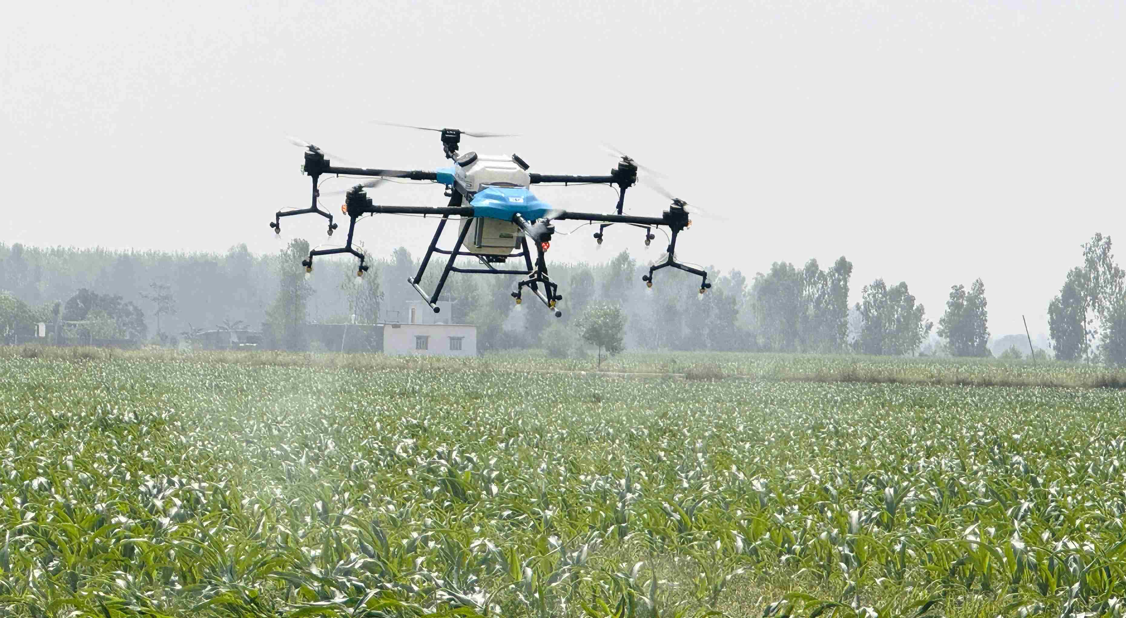
Agricultural Drone Services

Our drones are revolutionizing farming with precision agriculture solutions that reduce labor and increase yields. With advanced sensors, autonomous flight, and data analytics, we help farmers make better decisions and improve productivity.

  • Precision farming
  • Crop health monitoring via multispectral imaging
  • Soil and field analysis
  • Automated crop spraying and planting

Drone-Based Logistics & Delivery

Delivering supplies to hard-to-reach areas is now faster and safer with Azansys logistics drones.

  • Medical & Vaccine Delivery to rural and remote villages
  • Emergency Supply Drops in disaster zones
  • Industrial Parts Transfer within large factories or plants
​​​​​​​

Surveillance & Security Monitoring

For public safety agencies, private security firms, and government departments, Azansys offers intelligent drone surveillance services to enhance visibility and control.

  • Perimeter Monitoring (industries, campuses, borders)
  • Event Crowd Surveillance
  • Wildlife and Forest Area Monitoring
  • Disaster-prone Area Patrolling​​​​​​​

Firefighting & Emergency Response

Drones provide rapid situational awareness and help save lives during natural or man-made disasters.​​​​​​​

  • Detect fire hotspots using thermal imaging
  • Map affected areas quickly and safely
  • Deliver rescue kits, water bottles, or medicines
  • Coordinate with ground teams via real-time aerial visuals​​​​​​​

Your Vision, Our Technology: Perfect Harmony

Land Survey & Mapping Services

Our drones are equipped with high-resolution cameras and LiDAR technology to conduct fast, accurate, and affordable land surveys.​​​​​​​

  • 2D/3D Mapping of Land Parcels
  • Topographic Surveying
  • Mining Site Mapping
  • Urban Planning and Road Construction Projects

Customized Drone Solutions

Need something unique? We offer custom drone development and integration based on your business goals.​​​​​​​

  • Oil & Gas Pipeline Monitoring
  • Renewable Energy (Solar/Wind) Inspections
  • Environmental & Climate Research
  • Archaeological Site Mapping
  • Infrastructure Maintenance (bridges, towers, dams)

Why us

Why Choose Azansys Technology?

Expertise​​​​​​​​​​

A team of skilled professionals dedicated to delivering high-quality solutions.

Innovation 

Leveraging the latest technologies to stay ahead of industry trends.

Customization

Tailoring services to fit your unique needs and goals.

Reliability

Committed to providing dependable and efficient services.​​​​​​​

For more detail contact us

Contact Us